Survey Your Property Line With GNSS RTK
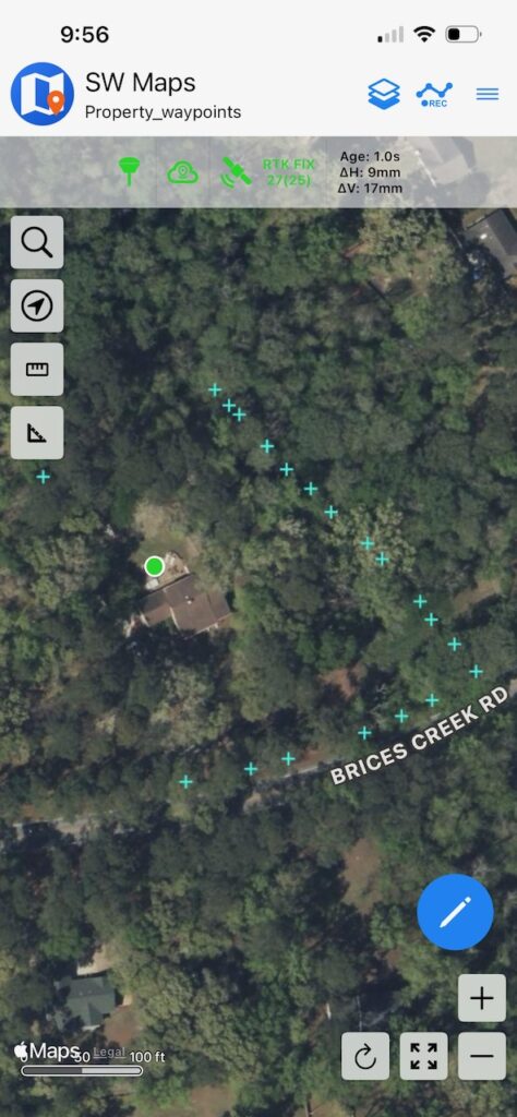
Let’s perform a survey on our property using GNSS RTK accuracy. Real Time Kinematics allows you to achieve 1 centimeter of accuracy in finding a location.
The absolute first thing I need to say about this is that doing your own survey does not provide official results unless you are a licensed surveyor.
All 50 states require a Surveyor to be licensed to perform such services as I’m describing here.
That being said I bought the home where I currently reside a few years ago in a private sale. I only have a rudimentary understanding of my actual property line. It is not marked as far as I can tell. If there are survey markers in the ground I’ve never seen one and I believe this area had its parcels defined in the late 1950’s.
Just from the satellite pic with my property waypoints that I obtained from official County documents and files I have a way better understanding of my boundaries.
Let me try to demonstrate how I did this.
Conversely, I have to say this again. If you are involved in some kind of property line dispute no court will accept your findings here as official. Even if your results mimic an actual survey, they probably won’t stand up. I’m confident that even with the heavy tree cover I can get within a foot or two of each point.
That will change soon as a company called RTKdata is going to allow me to install one of their RTK Base Station antennas on my property. At that point my rover will be within range of the base station at all times and I will have 1 centimeter accuracy.
I should state that RTKdata is going to send some operations folks out to my home to see if it is acceptable for their RTK network. I think it will be.
Continue reading