Category Archives: GPS

Coospo CS600 Maps – Building A Custom Map

Coospo CS600 Maps – Building A Custom Map

Coospo CS600 Maps

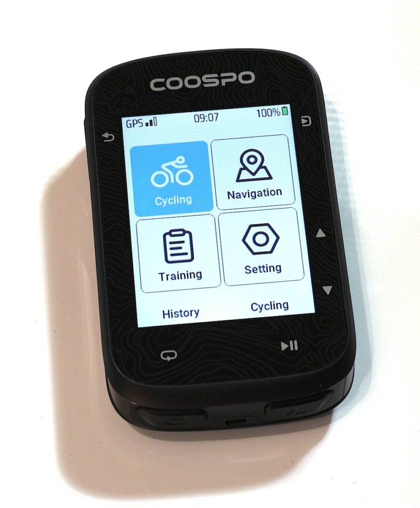
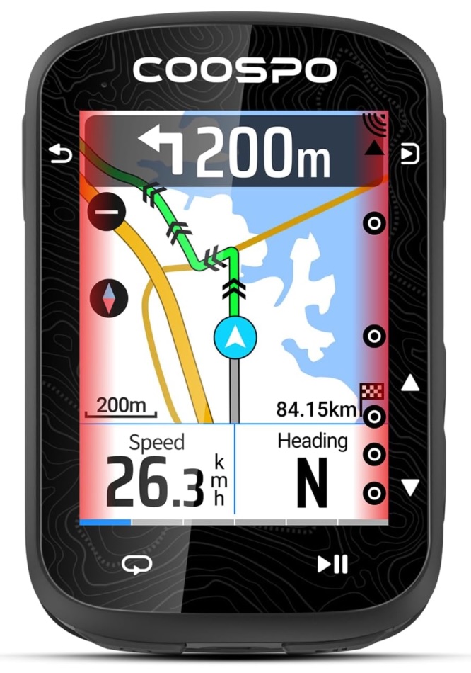
Boy this is one blog that I hope becomes irrelevant quickly. I’ve recently purchased a Coospo CS600 Bicycle Computer which I believe is breaking new ground in cycling computers. And by that, I mostly mean it is high quality hardware at a super affordable price. That being said, the Coospo CS600 Maps leave something to be desired.

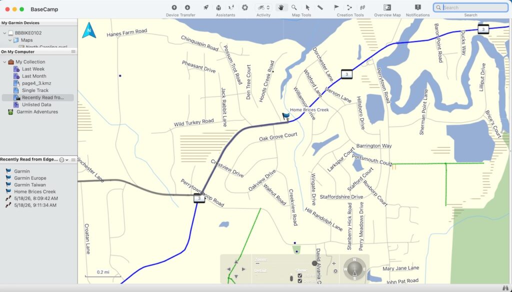
Making a custom map for a Coospo CS600 really leaves something to be desired.

I should add that the steps I use here may or may not even work for you. I did this on a Mac M1 Laptop with 16GB of RAM.

Map crunching takes a lot of horsepower and if the horsepower isn’t there then you have to finesse the commands to get it to crunch.

MOSTLY I AM DOCUMENTING THIS FOR MYSELF, BUT IF IT HELPS YOU, AWESOME.

Continue reading

Coospo CS600 Bicycle Computer Review

Coospo CS600 Bicycle Computer Review

Coospo CS600 Bicycle Computer

Well, I did it. I picked up the Coospo CS600 Bicycle Computer from Amazon. Allow me to get straight to it. It is very capable in the hardware department but the eco-system just isn’t quite there yet.

If they can develop that Garmin Connect or Fitbit type experience this will be a real contender for Gear Of The Year.

This actually has better hardware specs (mostly) than any Garmin I own. But Garmin has the long established and highly polished eco-system for their GPS and Bicycle Computers. Better hardware doesn’t always mean a better experience.

And I have discovered a quirk or two with the Coospo CS600 that, while not really affecting the overall experience, makes me scratch my head a little.

Quirk 1

One example: You can’t view a map on the CS600 unless you have a course uploaded to the device. Oh it is there but you can’t see it unless your course is loaded or the map options are turned on. Go to Settings > Ride Mode > Outdoor > Fields. Scroll to the bottom to find the Map option and turn it on.

Like I said, just a head scratcher.

Quirk 2

You simply cannot delete a single course you have uploaded to the device. Oddly though, “Delete All” is an option. I uploaded my regular route to the device and it uploaded as a date:time name. I wanted it to say “Ride To Pollocksville”. I couldn’t even figure out how to delete it from the app since it wasn’t showing in the app. I had to hook the CS600 to a computer via USB and then delete it from the Courses folder.

Again, just a head scratcher.

Continue reading

Can I Use A Budget Bike Computer? – Coospo CS600

Can I Use A Budget Bike Computer? – Coospo CS600

Coospo CS600

This is a bit of an unusual blog for me. I don’t own the Coospo CS600 bicycle computer yet and I am trying to decide whether to get one or not.

I don’t need one as I already own a Garmin Edge Explore 2, a Garmin Edge 530, and an old dawg, the Garmin Edge 705. Additionally, I bet you I have some old Cats Eye computers around here somewhere.

To answer my question in the Subject Line……Yes I could use one. Heck I just said I used Cats Eye bike computers before and they are as basic as it gets.

But I like to evaluate tech products and I like to ride bicycles. And if I crash and burn on said bicycle I’d be a lot happier destroying a $100 computer than a $300 computer. So the question remains, will the Coospo CS600 work for me?

Continue reading

Survey Your Property Line With GNSS RTK

Survey Your Property Line With GNSS RTK

GNSS RTK

Let’s perform a survey on our property using GNSS RTK accuracy. Real Time Kinematics allows you to achieve 1 centimeter of accuracy in finding a location.

The absolute first thing I need to say about this is that doing your own survey does not provide official results unless you are a licensed surveyor.

All 50 states require a Surveyor to be licensed to perform such services as I’m describing here.

That being said I bought the home where I currently reside a few years ago in a private sale. I only have a rudimentary understanding of my actual property line. It is not marked as far as I can tell. If there are survey markers in the ground I’ve never seen one and I believe this area had its parcels defined in the late 1950’s.

Just from the satellite pic with my property waypoints that I obtained from official County documents and files I have a way better understanding of my boundaries.

Let me try to demonstrate how I did this.

Conversely, I have to say this again. If you are involved in some kind of property line dispute no court will accept your findings here as official. Even if your results mimic an actual survey, they probably won’t stand up. I’m confident that even with the heavy tree cover I can get within a foot or two of each point.

That will change soon as a company called RTKdata is going to allow me to install one of their RTK Base Station antennas on my property. At that point my rover will be within range of the base station at all times and I will have 1 centimeter accuracy.

I should state that RTKdata is going to send some operations folks out to my home to see if it is acceptable for their RTK network. I think it will be.

Continue reading

Building A GPS Tracker – Come On Over Rover

Building A GPS Tracker – Come On Over Rover

GPS Tracker

This is actually a Global Navigation Satellite System (GNSS) but the term Global Positioning System or GPS is much more widely known. So “GPS” lands in the Heading of this page. Building a GPS Tracker is fun, albeit this one requires some proximity to WiFi or Bluetooth to surreptitiously track someone.

This isn’t the device you want to track your cheating spouse with, although I guess there are ways to make it work if your vehicle has onboard WiFi.

Shoving a burner phone under the dash and powering it with the 5 volts is probably the easiest way to get location data if you have access to the interior of the car. Anyway, I digress. This post is not about tracking anyone but yourself and learning how to achieve 1 centimeter accuracy.

This is a learning tool and a very cool one at that. You could throw this in the bicycle bag and track your rides, and yet again, a dedicated bicycle computer won’t necessarily track better than this. But that bike computer does lots of other things and makes your information easier to access.

So why build and use one? it really goes back to understanding the technology. We all use GNSS or GPS daily without even knowing it. But how many of us possess even rudimentary knowledge of how it works? Finally, this would be a nifty tool if the world descends into anarchy.

Continue reading

Garmin Basecamp And Maps – Seriously Garmin?

Garmin Basecamp And Maps – Seriously Garmin?

Garmin Basecamp

I bought my very first Garmin Bicycle computer in 2009. That same year Garmin released some mapping software called Garmin Basecamp.

It was, and is a decent hunk of software. Not great, but not bad.

And it hasn’t really changed since 2009. This is both good and bad. I imagine most of the changes are behind the scenes to keep up with modern computer operating systems. It’s great that the interface is so familiar but the flip side of that is the software looks like it is right out of the 2010’s. That’s okay, because a slick interface isn’t my thing anyway.

Continue reading

Hello Garmin, My Old Friend – Edge 705 Bike Computer

Hello Garmin, My Old Friend – Edge 705 Bike Computer

Garmin Edge 705

While rooting through my GPS container I stumbled across my old pal, the Garmin Edge 705 Bike Computer.

First released in 2007 it remains a viable bicycle computer and is still frequently popular on the secondary market.

I got mine in March 2009 and bought a Heart Rate Monitor and Cadence Sensor bundle for $479. Yikes!

Mine still looks brand new and still works perfectly……..well, almost perfectly. I found a gotcha.

When I first tried to boot up it was apparent that the battery was dead. The battery is a 3.7 volt Li-Po battery and generally any voltage reading of 3.0 or below means it is a dead duck. Mine was reading 2.4 volts. Quickly, to the Internet, Bike Man.

Continue reading

Real Time Kinematic (RTK) Basics

Real Time Kinematic (RTK) Basics

Real Time Kinematic positioning is a way to achieve 1-3 centimeters of accuracy using Global Navigation Satellite Systems (GNSS) or commonly referred to as GPS. GPS is specific to the satellite system established by the United States.

I’ve been dabbling with GNSS modules for a number of years. The accuracy with basic modules is usually around 3 meters which really isn’t bad to start with. However, the GPS you use in your car or phone knows what lane you are driving in. That of course requires a great degree of accuracy.

This blog is intended to be BASIC in nature. I’m not an expert. Yet. But I have learned some quick lessons that I want to pass on to anyone else wanting to dig into RTK.

Here’s a deeper explanation of the advantages of using RTKData networked stations provided by RTKData.com who have been most helpful in my education on this subject.

“RTKdata uses a single-station forwarding approach, meaning your rover receives corrections from one real, physical base station near you, selected automatically from a network of 20,000+ stations worldwide, rather than a synthesized virtual reference point calculated by interpolating between multiple stations.”

I can’t take credit for that statement since RTKData wrote it and provided it to me. That explanation is very concise and lays down the foundation for how networked RTK solutions can be superior to a single base station.

Continue reading

SparkFun LG290P Quadband GNSS RTK

SparkFun LG290P Quadband GNSS RTK

I’ve been messing with GPS modules for a while now. I’m always on the hunt for the best bang for the buck or the best learning tool. I recently stumbled across the Sparkfun LG290P Real Time Kinematic (RTK) GNSS board.

RTK has the ability to geo locate you to within 1 CENTIMETER of your location. Most GNSS modules net you about a 3 meter tolerance.

That is crazy accurate. Many of these RTK engines cost big $$$. This module is based on the Quectel LG290P engine. The good news is that it is lighter, cheaper, and runs cooler than most other RTK modules. Sparkfun sets the cost at $189 which is amazing.

Continue reading

GNSS200L GNSS Receiver Review

GNSS200L GNSS Receiver Review

GNSS200L GNSS

After digging through my GPS storage box I realized that I have never reviewed my GNSS200L GNSS receiver. I got mine at GPSWebShop a couple of years ago.

The advantage to this is that it is a puck and simply connects via USB to Windows, Linux, or MacOS.

There are no FTDI’s or serial converters needed. Just one clean USB connection to a computer.

Additionally, another major advantage is that because it is an authentic U-blox chip there is tons of documentation for it. If you buy some GPS module that is a knock off you aren’t going to get any documentation for it.

Continue reading